
PyrotechnickyPrieskum.sk — Mining & Pyrotechnic Legislation
Statutory compliance under § 63 of Act No. 58/2014 Coll., price calculations, and free plot history checks within 24 hours.
Why is preventive UXO survey essential?
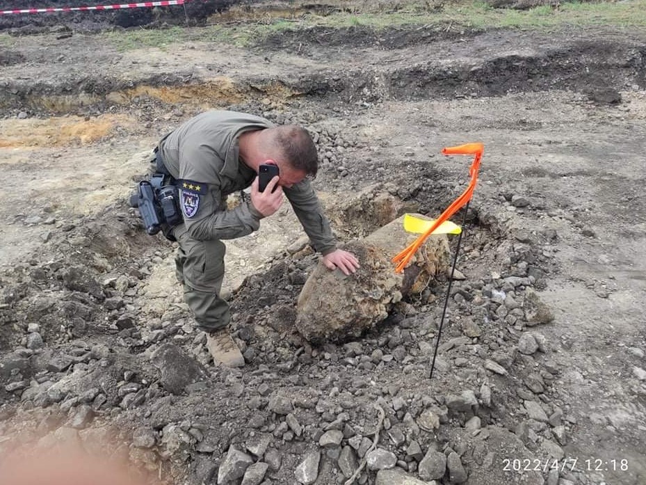
During World War II, the territory of the Slovak Republic was subjected to heavy strategic bombardment targeting key transport hubs, oil refineries, industrial centres, and bridges across the Danube and Váh rivers. A significant portion of aerial bombs, artillery shells, and mortar rounds failed to detonate on impact and remain concealed under soil at depths ranging from 0.5 m to 6.0 m.
During civil construction activities (earthworks, sheet pile driving, foundation piling, or topsoil stripping), striking unexploded ordnance poses a fatal hazard to human life and risks catastrophic equipment destruction. UXO clearance by W.T.A. Mapping a.s. provides contractors and developers with complete statutory certainty and verified safe access for heavy plant and machinery.
Survey methodology & technical instrumentation
Our multi-sensor geophysical methods eliminate the risk of overlooking concealed hazards while minimizing false excavation triggers caused by modern scrap:
- Multi-channel magnetometry Foerster FEREX 4.034: Industry-leading fluxgate gradiometer system detecting ferromagnetic targets down to 6.0 m depth, operating in georeferenced swathes with RTK GNSS sub-centimeter positioning.
- Deep electromagnetic induction Vallon VMR3 / VXC: Deployed in conductive soils and areas contaminated with reinforced concrete rubble where standard magnetometers experience saturation.
- Down-hole borehole logging: For deep foundations, bridge pier piling, and sheet pile walls, we lower axial magnetic probes directly into exploratory boreholes down to 15 m depth.
- Riverbed & water basin surveys: In-house CMAS P** (DIVE MASTER) certified diving unit equipped with boat-towed magnetometer arrays and submersible pulse detectors down to 30 m depth.
Comparative advantages of W.T.A. Mapping a.s.
Key technical and qualification distinctions ensuring uncompromised safety and zero construction disruption:
| Criterion | W.T.A. Mapping a.s. | Market Standard |
|---|---|---|
| Corporate Profile | 100% engineering geophysics and industrial site safety. Strictly B2B infrastructure focus. No consumer fireworks or retail sales. | Hobbyist pyrotechnics mixed with consumer firework sales and non-industrial blasting. |
| Personnel Licensing | Highest state licensing Category "E" and "D" issued by State Mining Authority under § 63 Act No. 58/2014 Coll. | Basic Category "C" or hobbyist permits without legal authority to manage large-scale infrastructure clearance. |
| Depth Reach | Down to 6.0–12.0 m (Foerster gradiometer arrays, borehole probes, deep GPR with 3D anomaly modeling). | Surface detectors reaching only 0.5–1.0 m without deep borehole verification capability. |
| Geodesy & GIS | In-house authorized geodetic engineer with RTK GNSS in S-JTSK / Bpv. Direct integration into BIM/DWG/GIS platforms. | Consumer-grade handheld GPS units with several meters of error. |
| Riverbed Capability | CMAS P** diving squad + specialized boat-mounted sonar and magnetometers (Váh, Danube, reservoirs). | No capability or certification for underwater and marine works. |
| Insurance Coverage | € 5,000,000 corporate liability policy (KOOPERATIVA Vienna Insurance Group). | Minimal liability or completely uninsured geophysical works. |
Key benchmark projects of UXO survey
- Šurany Industrial Park (GigaFactory): Full-scale magnetometric and UXO clearance across 3,200,000+ m² for MH Invest s.r.o. prior to earthworks.
- Strategic Territory Valaliky (Volvo Car Slovakia): Strategic industrial park clearance with discovery and safe neutralization of a 500 lb aerial bomb and artillery shells.
- Expressway R2 Kriváň – Mýtna: Deep borehole and surface survey across steep forested terrain for 45m high bridge viaduct pillars.
- Váh Riverbed (ŽSR Railway Bridge): 30,000 m² underwater survey at km 117.48 near Trnovec nad Váhom utilizing boat magnetometry and CMAS divers.
Statutory compliance & apparatus (§ 62 & § 63 Act No. 58/2014 Coll.)
Under Slovak mining legislation, unexploded ordnance detection falls under the stringent supervision of the State Mining Office. W.T.A. Mapping a.s. maintains:
- State Mining Office Authorization for Category "E" and "D" pyrotechnic activities.
- Chief Pyrotechnic Officers certified in the official State Mining Registry.
- Calibrated, certified instrumentation meeting European metrology standards.
- Approved operational protocols and emergency containment procedures.
Need an expert technical evaluation for your project?
Send us parcel numbers or CAD boundaries. Within 24 hours we verify the site's military history and provide a binding method and price quote.