PROTOKOLÁRNY ZÁPIS ODOVZDANIA PZ SR
Lokalita: | Partner / Zhotoviteľ:
We perform multi-channel site magnetometry, 3D riverbed sonar mapping, and geophysic subsurface diagnostics for motorways, bridges, and industrial parks in Slovakia. Contracted partner for Šurany (105 ha), Volvo Valaliky, R2 Kriváň – Mýtna (1,075,000 m²) and R2 Mýtna – Tomášovce (1,200,000 m²).
W.T.A. Mapping a.s. (Pezinok) conducts pyrotechnic surveying (UXO) pursuant to § 63 of Act No. 58/2014 Coll., hydrographic sonar riverbed mapping, and non-destructive engineering geophysics. Chairman of the Board: Mgr. Marek Škultéty, MBA, LL.M.
We act as the contracted partner for prime civil engineering consortia including Doprastav, Strabag, Eurovia, Metrostav, Hochtief, MH Invest, and Slovak Railways (ŽSR). Operations are led with supreme statutory authorization from the District Mining Authority in Bratislava (Categories „E“ and „D“ pursuant to § 63 of Act No. 58/2014 Coll.) compliant with ISO 9001, ISO 14001, and ISO 45001.
In field operations, we deploy our own CMAS P** (Dive Master) certified commercial divers, an authorized geodetic engineer for measurements in the S-JTSK and Bpv national coordinate datums, and military archival researchers (1944–1945 operational logs, USAAF 15th Air Force bomb strike maps).
Statutory supervision and management of UXO surveys in Slovakia with full civil & corporate legal liability.
Every subsurface anomaly is surveyed with RTK GNSS in S-JTSK / Bpv and exported directly to CAD & GIS layers.
We detect unexploded wartime munitions prior to excavation work. We deploy multi-probe Foerster FEREX magnetometry arrays and deep GPR. Following site remediation, we issue the official Site Clearance Certificate for municipal building authorities.
Specialized non-destructive diagnostics of civil ground, riverbeds, and geological bedrock engineered according to verified European standards.
Multi-probe site magnetometry using Foerster FEREX 4.034 4-channel gradiometers with RTK GNSS centimetre positioning. Target excavation, identification, and certified handover to Slovak Police ordnance disposal.
View Methodology & Parameters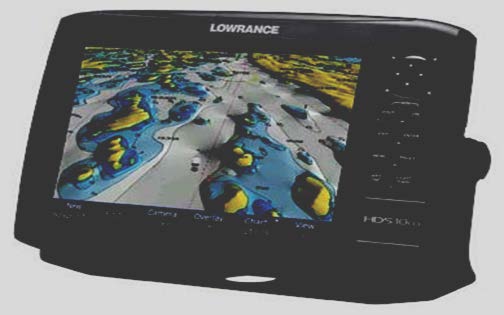
High-frequency acoustic relief scanning, 3D digital riverbed terrain models (DTM), and bridge pier scour inspections on the Danube and Váh rivers with our certified CMAS P** commercial dive team.
View Methodology & Parameters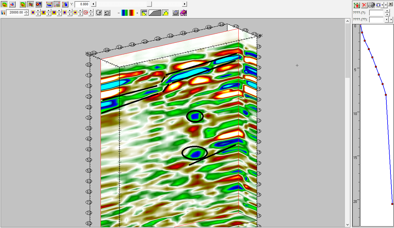
Non-destructive subsurface diagnostics down to 15 metres. Precise localization of buried utility networks, unmapped cellars, voids, old structural foundations, and geological faults prior to foundation piling.
View Methodology & Parameters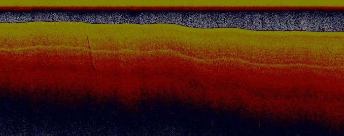
Shallow-draft vessel magnetometry, inspection of underwater bridge pier footings to 12 m depth, and riverbed tactile verification by CMAS P** divers (Danube, Váh, Morava).
View Methodology & ParametersReal-time simulation of multi-channel field magnetometry and radiolocation. Select a project and click any detected anomaly dot to view its geodetic passport.
Projekt: Šurany Industrial Park (105 ha). Každé meranie je vykonávané v reálnom čase s centimetrovým RTK GNSS určením polohy a archivované pre potreby kolaudačného konania.
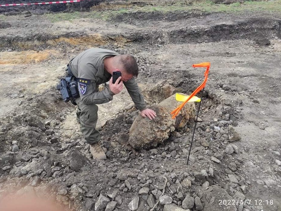
Authentic selection of unexploded wartime ordnance located by W.T.A. Mapping a.s. specialists and safely transferred to the Pyrotechnic Disposal Service of the Police Corps of the Slovak Republic.
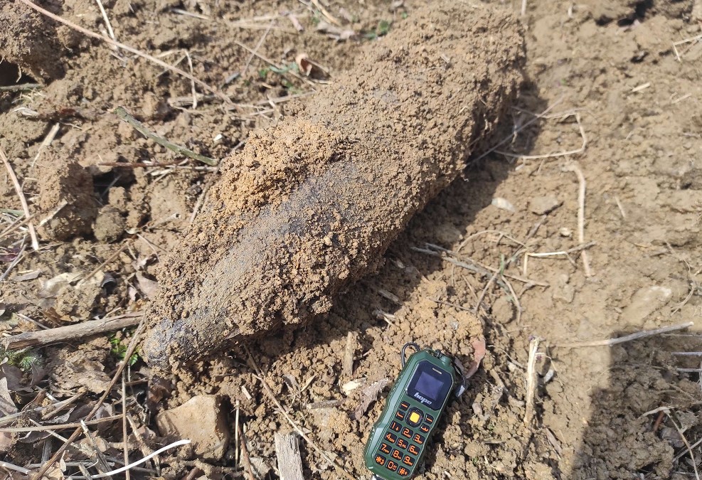
227 kg (500 lb) Bomba
Masívna nevybuchnutá letecká bomba objavená priamo v koľajovom obvode. Okamžite zabezpečená a protokolárne odovzdaná policajným pyrotechnikom.
Zobraziť technický pasport →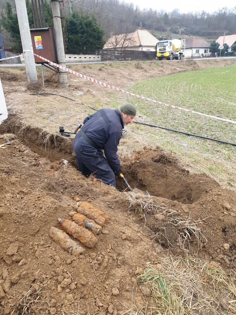 6 ks projektilov 75 mm
Hromadný nález 6 kusov delostreleckej munície vo výkope. Včasná magnetometrická detekcia predišla detonácii pri strojovom bagrovaní.
Zobraziť technický pasport →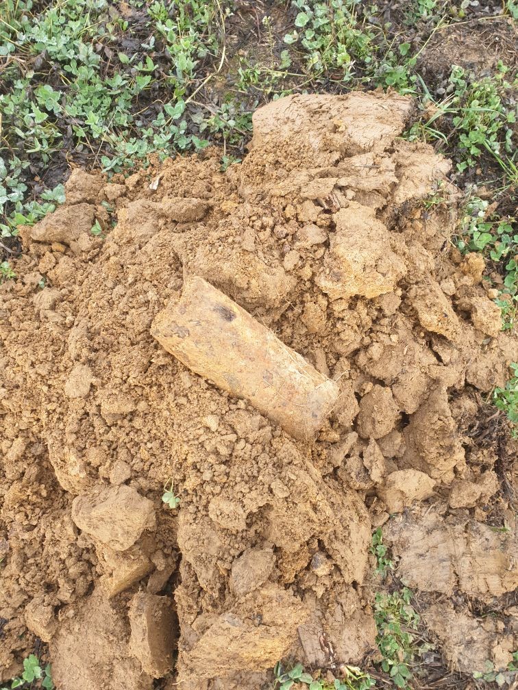 105 mm Šrapnel
Ťažká delostrelecká munícia detegovaná magnetometrickou aparatúrou v hĺbke 0,8 m p.t. pred vjazdom ťažkej techniky investora.
Zobraziť technický pasport →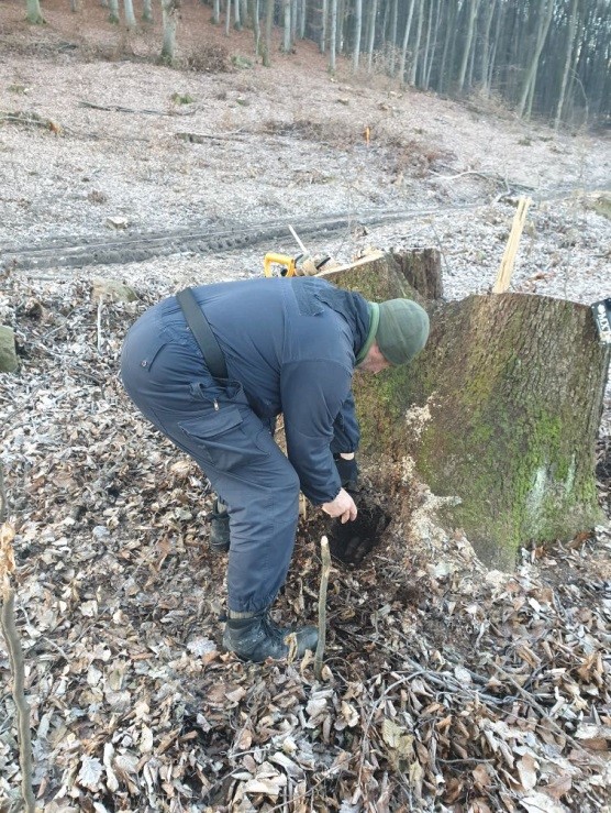 2x puškový granát Pzgr40
Odkrytie v koreňovom systéme stromu na strmom svahu budúcej mostnej estakády s využitím špeciálnej lesnej metodiky W.T.A. Mapping.
Zobraziť technický pasport →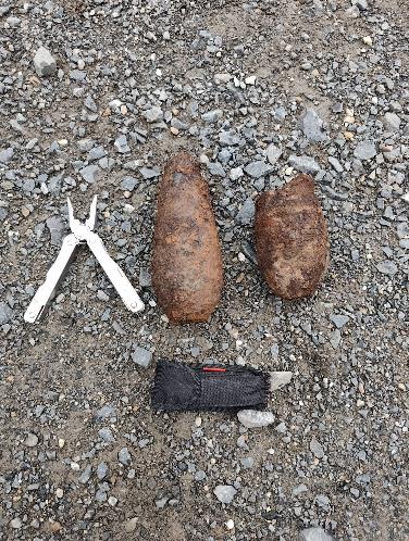 2x sovietsky 80 mm mínomet
Nález 2 kusov sovietskej munície z 2. sv. vojny v koryte rieky Váh medzi piliermi č. 4 a 5 (nález 16.02.2026). Protokolárne odovzdané PZ SR a OBÚ Bratislava.
Zobraziť technický pasport →
S-JTSK Geodetické zameranie
Demonštrácia presného terénneho zamerania každého nálezu certifikovaným geodetom pre Záverečnú správu stavebnému úradu a kolaudáciu.
Zobraziť technický pasport →An unexpected munition find on an unsurveyed construction site triggers immediate police shutdown (158), 50–500 m perimeter evacuation, and labor safety investigations. Configure your site metrics:
Authentic field survey outputs: GPR radargrams, 3D LiDAR point clouds, and centimetre-accurate anomaly coordinates in S-JTSK / Bpv.
Switch the depth horizon to inspect real diagnostic technology and methodology:
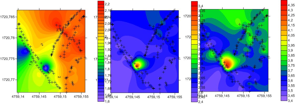
Presná 3D digitálna ortofotomapa záujmového staveniska s centimetrovým určením hraníc parciel a viditeľných geomorfologických prekážok.
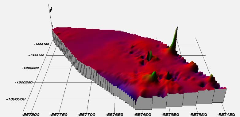
Spatial point cloud of the Danube riverbed in Bratislava. Precise bathymetric scour analysis and bridge pier foundation stability with anomaly & UXO detection.
Deep GPR radargram identifying geological layer interfaces and buried rubble anomalies along planned highway infrastructure prior to foundation piling.
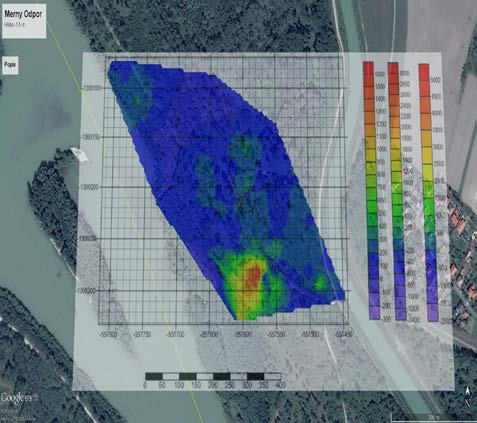
Acoustic sonar survey of sedimentation dynamics and cross-sectional flow profiles on the Danube (Dobrohošť reach) with contour generation in W.T.A. software.
Comprehensive UXO, sonar, and geophysical surveys for strategic industrial gigafactories, motorways, and railway bridges in Slovakia.
UXO clearance of expressway alignment along the Kriváň stream valley in parallel with the Zvolen – Fiľakovo railway line and road I/16 at the foothills of Divín.
UXO survey of expressway corridor including foundations for the 5 km high-level viaduct in the Kriváň valley. Total area: 1,075,000 m².
Multi-probe array magnetometry (105 ha) and complete pyrotechnic clearance of the industrial park for the national EV battery gigafactory.
Complete magnetometric scan (44 ha) and issuance of site safety certification for the Volvo electric vehicle manufacturing facility.
Preventive magnetometric inspection of the 15 ha industrial park prior to gross grading and civil utility network installation.
GPR subsurface utility mapping and UXO inspection for Stage 2 of the Petržalka tram line extension in Bratislava.
UXO and multi-channel magnetometric survey of the Váh riverbed at km 117.48 around railway bridge piers and pilings using commercial divers.
Pripravujete súťažné podklady pre NDS, ŽSR, samosprávy alebo priemyselné parky? Skopírujte si pripravenú technickú špecifikáciu podľa § 63 zákona č. 58/2014 Z. z., ktorá zabráni podávaniu ponúk nekompetentným subjektom bez oprávnenia „E“:
VZOROVÁ ŠPECIFIKÁCIA: PYROTECHNICKÝ A GEOFYZIKÁLNY PRIESKUM STAVBY
1. PREDMET PLNENIA: Odborný pyrotechnický a geofyzikálny prieskum staveniska v zmysle § 63 zákona č. 58/2014 Z. z. o výbušninách, výbušných predmetoch a munícii.
2. OPRÁVNENIE PERSONÁLU: Zhotoviteľ musí preukázať, že vedúci pyrotechnických prác disponuje platným oprávnením Hlavného banského úradu kategórie „E“ (riadenie pyrotechnických prác) a kategórie „D“.
3. PRÍSTROJOVÉ VYBAVENIE: Zhotoviteľ použije viackanálový feromagnetický gradiometrický systém s frekvenciou vzorkovania min. 100 Hz s prepojením na RTK GNSS aparatúru s presnosťou do 2 cm.
4. DIGITÁLNE VÝSTUPY: Súčasťou Záverečnej správy je digitálna mapa magnetických anomálií v štátnom súradnicovom systéme S-JTSK a výškovom systéme Bpv vo formáte AutoCAD (DWG) a GIS vrstiev (SHP).
5. CERTIFIKÁCIA MANAŽÉRSTVA: Platný certifikát ISO 9001:2015, environmentu ISO 14001:2015 a BOZP ISO 45001:2018 pre oblasť geofyziky a pyrotechnického prieskumu.
6. POISTENIE ZODPOVEDNOSTI: Platná poistná zmluva na krytie škôd spôsobených prevádzkovou a pyrotechnickou činnosťou v minimálnej výške 5 000 000 €.